
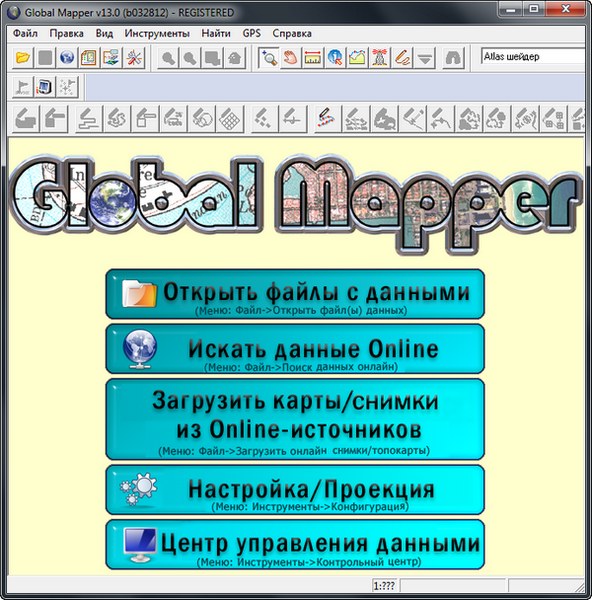
Global Mapper 13.0 Build 032812
Официальная русская версия!
Global Mapper - приложение, позволяющее просматривать, конвертировать, преобразовывать, редактировать и распечатывать различные карты и векторные наборы данных. Графические данные могут быть загружены в качестве слоев или как отсканированная топографическая карта для 3D изображения местности. Может работать в реальном времени, загружая данные с GPS-приёмника. Global Mapper поддерживает множество форматов, имеет большое количество инструментов и опций. Может рассчитывать расстояния между объектами.
Возможности программы:
- Поддержка просмотра основных форматов данных
- Прямой доступ к DigitalGlobe, TerraServer-USA, WMS и другим источникам
- Поддержка просмотра 3D ландшафтов
- Обрезание, перепроектирование и слияние любых комбинаций растровых данных и данных возвышенностей
- Оцифровывание новых векторов с возможностью их перемещения
- Совместимость с GPS устройствами через компьютерный серийный порт или USB порт
- Поддержка конвертации между большим списком проектных систем и исходных данных
- Экспорт в векторные и растровые данные
- Графическое исправление любых JPG, TIFF или PNG изображений и сохранение результатов в новое изображение
- Создание контуров для любых комбинаций данных возвышенностей
- Загрузка и отображение JPG изображений со встроенными EXIF данными о позиции
- Поддержка NASA World, Google Maps, Virtual Earth
- И многие другие возможности
ОС: Windows 98, Windows NT, Windows 2000, Windows ME, Windows XP, Windows Vista, Windows 7 and Windows Server 2003.
Изменения в версии 13.0
Significant New Features
New Supported Formats
Projection/Datum Changes
Scripting Changes
Significant New Features
- Added support for loading ESRI File Geodatabase (GDB) data sets from ArcGIS v10 and later.
- Added support for generating density grids from point features in a loaded layer. This density grid can be based on either just a count of the point features or any numeric attribute value associated with the points.
- Added support for joining a file with attributes to the attribute table of an existing loaded spatial layer against a common attribute. To do this, right-click on the layer in the Control Center and select the new JOIN TABLE option.
- Added support for calculating/copying new attribute values made by copying an existing attribute or performing mathematical operations either between two attribute values or an attribute value and some number. To do this, right-click on the layer in the Control Center and select the new CALC ATTR option.
- Added built-in access to premium streaming high-resolution terrain and imagery from Intermap using the File->Download Online Imagery/Data menu command.
- Added option under View menu to zoom to the same location in Google Earth.
- Added option to transform layer coordinates either by a manually specified coordinate transformation or with a control point file when shifting coordinates for selected layers from the Control Center in addition to just shifting a fixed distance.
- Added option to crop area features to line features using the Digitizer Tool.
- Added option to easily draw rotated area and line rectangles using the Digitizer Tool through the 3-point draw method.
- Added new Image Swipe Tool to allow easily swiping away a raster layer to see other layers in an interactive manner.
- Added option to create line features rather than areas when creating a regular grid of features using the Digitizer Tool.
- Added option to create point features at the cell edges when creating a regular grid of features using the Digitizer Tool. This can be handy for creating a custom grid labeled with the coordinate values at the edges.
- Added option to create a line feature from selected point features.
- Added a new option to the Advanced Feature Creation submenu of the Digitizer Tool to create lines connecting selected points to selected line features along the shortest path between the point and any of the selected lines.
- Added option to Digitizer Tool to automatically move selected point features to the nearest point on selected line features.
- Updated drawing of area and line features to allow easily drawing new segments at right angles to previous segments by holding down the ‘R’ key.
- Added option to only search on-screen features in the search dialog.
New Supported Formats
- Added support for loading ESRI File Geodatabase (GDB) data sets.
- Added support for exporting loaded terrain data to SRTM HGT format files.
- Added support for loading SegY format files.
- Added support for loading NMGF (Noise Model Grid Format) files.
- Added support for loading ATLAS BNA (boundary) format files.
- Added support for exporting loaded data to XY Color text files.
- Added support for exporting 3D triangle areas to Vulcan 3D TIN (.00t) files.
- Added support for additional ways of encoding ASTER DEM data in HDF files.
- Added support for loading NOAA/NGA Geoid binary grid shift files.
- Added support for additional types of Japanese DEM files in LEM format.
- Added support for Geosoft Grid files with 8-byte double-precision samples.
- Added support for batch converting to Garmin-compatible KMZ files.
Projection/Datum Changes
- Corrected NAD83 HPGN/HARN transformations that were messed up in v12.02.
- Made Washington/Oregon HPGN/HARN transformation actually work.
- Added support for automatically transforming vector file coordinates using a .gm_xform file accompanying the data file describing the transformation. This is useful for modeling things like local mine grids.
- Updated rotation for projections to be applied relative to the false easting/northing location rather than the (0,0) point.
- Added built-in support for Dealul Piscului 1933 (Romania), Le Pouce 1934 (Mauritius), NAD83 HARN North Carolina, WI County (Chippewa), WI County (Taylor), and Xian 1980 datums.
- Added support for Cape Feet, Centimeters, and Millimeters as linear units.
- Made British Grid coordinates be displayed in the status bar with the 2 letter grid cell designation followed by easting and northing rather than just as decimal coordinates.
- Make NAD83 datums write out as “NAD83” rather than “D_North_American_1983” to old format PRJ files to maintain compatibility with old ESRI products.
- Corrected EPSG code for NY West Sate Plane zone to 2262 from 2261.
- Improved conversion parameters for ED50 (Turkey) datum.
- Fixed cropping to polygon during EXPORT_RASTER command.
- Improved accuracy of some State Plane projection conversions that used non-unity scale factors (increased from 6 to 9 digits of precision used for State Plane projection definitions).
- Made Provisional South American Datum 1956 (PSAD56) export correctly to MapInfo files.
- Fixed New Zealand EPSG codes 27291 and 27292 (the false easting and northing values were wrong).
- Corrected import of scale factor from custom datum transformations specified with TOWGS84 in PRJ files.
- Improved accuracy of Bursa Wolfe datum transformations with large rotation angles (i.e. more than a few arc seconds of rotation).
- Corrected use of wrong datum transformation in some cases when using the non-specific NAD83 CSRS datum.
Scripting Changes
- Added support for simplifying (reducing) line features with the EDIT_VECTOR command using the SIMPLIFICATION parameter.
- Added support for converting area features to line features with the EDIT_VECTOR command using the CONVERT_AREAS_TO_LINES parameter.
- Added support for inserting vertices at line intersections and splitting those lines at those intersections with the EDIT_VECTOR command.
- Added support for assigning unique ID attribute values to matching features for an EDIT_VECTOR script command using the UNIQUE_ID_BASE parameter.
- Made SAVE_SCALE_AND_LEGEND work for EXPORT_PDF command.
- Added FORCE_RGB parameter to GENERATE_EQUAL_VAL_AREAS script command to allow forcing the color attribute to use the full RGB color and not a palette index.
- Added support for EXPORT_HEADER parameter for EXPORT_VECTOR command to control whether or not header row is written out for CSV export.
- Added support for exporting to the InRoads ASCII format using the EXPORT_VECTOR command.
- Added FORCE_EXIT command to allow forcibly closing a running instance of Global Mapper from a script.
- Updated EDIT_VECTOR command to not work on hidden/disabled layers.
- Added support for limiting the range of contour generation using MIN_ELEV and MAX_ELEV parameters for the GENERATE_CONTOURS script command.
- Allow splitting DTED exports into folders by longitude using the EXPORT_ELEVATION command by adding a SPLIT_INTO_FOLDERS=YES parameter.
- Added support for calculating free space path loss during view shed calculation and making those areas with less power more translucent. You can also see the remaining power at any location on the status bar as you move your cursor over the view shed.
- Added display of the free space path loss in the path details for a line of sight calculation when Fresnel zones are calculated.
- Updated the KML export to include a <gx:Track> section for lines that have per-vertex time stamps associated with them so you can play them back in Google Earth.
- Added support for supplying radius for range ring generation from selected points through a RING_RAD_M attribute which supplies the radius in meters.
- Updated the Simple ASCII Text export to use DMS or DM format for lat/lon values exported to text files if the Position Display Format is configured that way on the General tab of the Configuration dialog.
- Added option to SEGP1 export allowing elevation values to be stored with an implied decimal.
- Updated similar color transparency specification on the Display tab of the Options dialog for raster layers to provide a slider to control how similar a color can be to the transparent color and still be treated as transparent. This replaces the checkbox option to enable similar color transparency so that more control is possible.
- Updated option to insert vertices at line intersections to allow only splitting where there are existing intersections and not inserting new vertices.
- Added option to Alter Elevations tab of Options dialog for elevation grid layers to allow providing a power to apply when adjusting elevation values.
- Added new option to the Options menu on the Path Profile/Line of Sight dialog to allow creating point features at the minimum and maximum elevation locations along the path.
- Added new ‘Dot – Orange’ built-in symbol.
- Changed the border color for red and green dots to black from white.
- Improved grouping of Control Center right-click menu options to make them easier to find and also added upper-case one word descriptions to the start of some commonly used options to make them easier to spot.
- Added option to Control Center right-click menu to allow hiding all layers that don’t intersect a selected area.
- Added option to split Shapefile exports based on the description of the layer that each feature is in.
- Added upper-case short descriptions of some commonly used items on the right-click menu for the Digitizer Tool.
- Updated creation of equal value areas to allow color fuzziness up to 256 to allow easily getting a polygon for the valid area of the layer.
- Added Ctrl+Alt+M as shortcut for Measure Volume functionality in Measure Tool and Digitizer Tool.
- Added new Advanced Selection option to the right-click menu in the Digitizer Tool to allow easily selecting any area features that are connected to the selected areas.
- Added new Advanced Selection option to the right-click menu in the Digitizer Tool to allow easily selecting any line features that are connected to the selected areas.
- Fixed problem loading *.NTF files in v12.02.
- Added support for adding a suffix to the row and column names when creating a regular grid of area or line features with the Digitizer Tool.
- Updated KML/KMZ raster exports to allow specification of JPG quality value.
- Added 2 new filtering modes for the Combine Terrain operation. You can now choose to keep the value from the first elevation layer if the second layer value is greater than or less than some other user-specified value.
- Allow specifying a suffix for the label for points generated from selected area or line features (in addition to a prefix which you could already specify).
- Added option to generate AutoKA PC World Files when batch converting to image formats.
- Added option to use the layer name for a feature as the label for the feature in an automatically generated map legend.
- Added support for coordinates in DDMMSS.S and DDMM.M formats when loading from generic ASCII text files.
- Added real-time display of 16-bit values from high-bit depth TIFF imagery files as you move the cursor over the file.
- Updated adding of measure attributes to 3D line features to include a LENGTH_3D attribute with the 3D length of the line if it is different than the 2D length.
- Fixed export of overview layers to Erdas Imagine .img files from map catalogs.
- Added display of maximum slope along path to 3D path profile details.
- Added support for fractional coordinates of form degrees.numerator/denominator. For example, to enter W94.125, you could now enter W94.1/8.
- Fixed fill coloring from some DGN files.
- Added support for NetCDF files larger than 2GB in size.
- Fixed problem from v12.00 with drawing elevation Erdas Imagine .img files when zoomed out if the files have overview layers.
- Added option when creating point features spaced at some interval along selected area/line features to control whether or not a point is always added at the feature end point even if not at an exact multiple of the sampling distance.
- Added option to not interpolate (resample) when batch converting to a gridded elevation format.
- Fixed problems loading data from WMS servers that list both GET and POST methods for accessing the servers (like GeoPortal Poland).
- Lightened up the outside color of displayed vertices to make them easier to see on dark backgrounds.
- Fixed problem with crashes exporting from online elevation sources.
- Made the simplification (reduction) of area features not create self-intersecting areas.
- Made some PDS imagery files that use floating point samples for single band imagery (like from NASA’s LRO mission) display properly.
- Sped up exports to Arc ASCII Grid files from large numbers of input files.
- Fixed error saving workspaces and Global Mapper Package files when new areas with islands have been created in a layer.
- Made the feature info dialog display the description for a layer from the Control Center as the Map Name rather than the original description.
- Fixed RasterOverlay.cpp error loading some JP2 and ECW files with 16-bits per color channel.
- Improved display of arrows to the ends of lines for thick lines and fixed width lines.
- Fixed download of WCS data in projections other than lat/lon/WGS84.
- Added support for NITF imagery using tiled JPEG compression (code M3).
- Swap the drawing for area and line rectangles to by anchored at the top left by default, and switched to center-anchored if the ‘T’ key is pressed.
- Made most view shed parameters be remembered between runs.
- Fixed cropping to lat/lon boundary for polar stereographic projections.
- Fixed bug updating the elevations for selected vertices on the Vertices dialog for a feature (previously it was just setting the elevation to the index of the vertex and not the actual elevation).
- Fixed problem with some OSM XML files taking extreme amounts of memory to load.
- Default to always show digitizer toolbar to prevent redraws when switching to Digitizer Tool. You can always turn this off if you want, it just defaults to on now.
- Reduced memory required to load large Lidar LAS files as point clouds.
- Updated the calculation of area elevation statistics to include the position of the minimum and maximum elevation found within the area.
- Added support for providing extra parameters in OSM, TMS, and Google Maps tiled URLs when adding new sources.
- Added support for Arc ASCII Grid files with extra line breaks after the header lines.
- Fixed drawing of striped lines with black edges when printing.
- Corrected Y flip of SurvCAD grid files.
- Made 3D lines show through 3D translucent areas in the 3D view.
- Fixed render issues with some GeoPDF files.
- Corrected loading of MTEXT entities from DXF files with rotation elements provided.
- Added support for reading and writing receiver group records in UKOOA P-190 files.
- Corrected generation of area features for some VPF data sets (i.e. VMAP-1).
- Added support for loading uncompressed 32-bit tiles from Arc Binary Grid files.
- Made using Java filenames the default when exporting WorldWind tiles.
- Added Ctrl+E shortcut to Overlay Control Center providing quick access to edit the description of selected layers.
- Added new option to disable the automatic bilinear interpolation of terrain layers on load to the Advanced section of the General tab of the Configuration dialog.
- Corrected creation of equal-value elevation areas around zero.
- Fixed issue with duplicate area entries in the map legend sometimes.
- Fixed bug with some exported SVG files having an extra group close.
- Fixed export of text labels from points with no symbol to SVG files.
- Made ‘fill to tile bounds’ option work for OSM and TMS exports.
- Added progress reporting and cancel support for selecting areas that are included within or intersect other areas with the Digitizer Tool.
- Added support for loading GIF images from KMZ files.
- Fixed loading of curves from DGN files.
- Made layer names for inserted BLOCK entities in DXF files be assigned properly.
- Added new Advanced option to tiled web format exports (i.e. Google Maps, Bing Maps, OSM, and TMS) to use PNG files rather than JPG files whenever background pixels are encountered during the JPG export.
- Added new options to Google Maps tiled export to make the custom map be a basemap layer rather than an overlay layer and to control whether the zoom, pan, and street view controls are added.
- Fixed use of feet as receiver or transmitter height units for view shed calculation.
- Added option to save the results of a ‘Find Non-Connected Line Endpoints’ operation to a file.
- Added support for NMEA GPS devices that use $DPGGA position sentences.
- Added options to DWG and DXF exports to allow exporting labels longer than 31 characters.
- Added option to Polish MP export to save out all feature attributes and not just those defined by the MP format.
- Made OSM export use lower-case text for all attribute names.
- Fixed crash when inserting vertex along closing leg of area feature.
- Fixed grid line placement when margins are present on Map Layout dialog.
- Do a little bit smarter address search when no 'ADDRESS' field is found in file to geo-code but other fields are.
- Allow specification of new elevation values on feature vertex dialog with comma for decimal place rather than period.
- Added CLOSED_CONTOUR attribute to automatically generated contour lines that are closed.
- Added ELEVATION attribute to automatically generated contours so the elevation is available as an attribute as well as the display label.
- Added support for using LZW or Deflate compression on elevation GeoTIFF files.
- Added new option to the Advanced section of the General tab of the Configuration dialog to disable the prompt to skip loading files that are already loaded.
- Added new option to the slope direction shader to allow providing an offset angle to allow for checking alignment against angles other than cardinal directions.
- Fixed problems with attribute names with accent characters not working to add display labels from in some cases.
- Fixed error loading NITF files with JPEG2000 encoding over 2GB in size.
- Improved reading of SHP files with no SHX file.
- Fixed issue with red box around point location for 'No Symbol' points with text exported to KML/KMZ files.
- Added JPG quality setting to Google Maps/Bing Maps/OSM/TMS export dialog.
- Updated option for selecting lines within area to allow selecting those lines that are just partially in the area in addition to those completely within the area.
- Allow export of grid lines to Shapefiles even if no other line features are loaded.
- Added support for extracting feature attribute information from <ExtendedData> section of <Placemark> entities in KML/KMZ files.
- Added option to the Advanced section of the General tab of the Configuration dialog to minimize the main window during exports.
- Made simplification and smoothing operations work on un-selected island areas.
- Made the aspect ratio always be maintained when saving the 3D view to an image file.
- Made SVG exports include an “id” values with a unique number for each exported feature.
- Updated GPS menu item for sending custom raster maps to a connected Garmin device to have an option to specify the maximum map count. This default to 100, but you can increase it for newer units that support more than 100 map tiles.
- Fixed problem exporting Ozi .ozf images to palette-based formats.
- Updated JPG2000 export to internally tile the created image to 1024x1024 tiles.
- Made Lidar points marked as “withheld” be automatically marked as deleted on import.
- Improved vector search dialog so that moving features to a new layer doesn’t reset the sort and column sizes.
- Added option to default GeoTIFF export to use no compression to the Advanced section of the General tab of the Configuration dialog.
- Added option to the GeoTIFF export dialog to disable the writing of GeoTIFF header information to the generated file. This is useful for using things like datum specializations that can’t be exactly stored in GeoTIFF files, so you’d rather just use a PRJ file and not have anything in the GeoTIFF file.
- Updated SEGP1 import to default to feet for the elevation units if statute is selected for the elevation display/export units on the Vertical Options tab of the Configuration dialog.
- Added option to the Vector Display tab of the Configuration dialog to set the default character set for fonts to allow easily switching default fonts to a non-Western European character set.
- Made export of distance/Z file from path profile dialog work properly when a non-zero base distance is specified.
Скачать программу Global Mapper 13.0 Build 032812 (50,69 МБ):

aks85 23/06/12 Просмотров: 7240
0
Программа действительно очень хорошая, но вот официальная русская из версии в версию повторяет одну и туже ошибку из за которой снижается функционал программы.
А Андрей Березин так замаскировался, что его адреса нет ни на сайте глобал мапера ни на сайте русификаторов.
Может кто знает где найти этого конспиратора?